Hyper-resolution mapping of regional storm surge and tide flooding: comparison of static and dynamic models
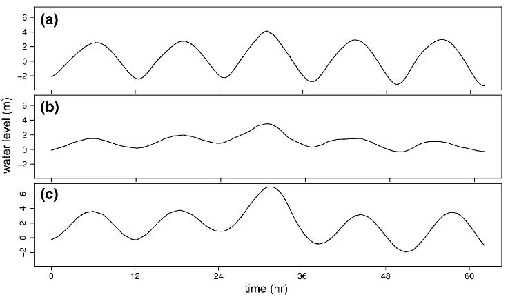
Storm tide (combination of storm surge and the astronomical tide) flooding is a natural hazard with significant global social and economic consequences. For this reason, government agencies and stakeholders need storm tide flood maps to determine population and infrastructure at risk to present and future levels of inundation. Computer models of varying complexity are able to produce regional-scale storm tide flood maps and current model types are either static or dynamic in their implementation. Static models of storm tide utilize storm tide heights to inundate locations hydrologically connected to the coast, whilst dynamic models simulate physical processes that cause flooding. Static models have been used in regional-scale storm tide flood impact assessments, but model limitations and coarse spatial resolutions contribute to uncertain impact estimates. Dynamic models are better at estimating flooding and impact but are computationally expensive. In this study we have developed a dynamic reduced-complexity model of storm tide flooding that is computationally efficient and is applied at hyper-resolutions (<100 m cell size) over regional scales. We test the performance of this dynamic reduced-complexity model and a separate static model at three test sites where storm tide observational data are available. Additionally, we perform a flood impact assessment at each site using the dynamic reduced-complexity and static model outputs. Our results show that static models can overestimate observed flood areas up to 204 % and estimate more than twice the number of people, infrastructure, and agricultural land affected by flooding. Overall we find that that a reduced-complexity dynamic model of storm tide provides more conservative estimates of coastal flooding and impact.
J. A. Ramirez, M. Lichter, T. J. Coulthard, C. Skinner
- Natural Hazards

